Features SEN4ALL
APPLICATION FOR LAND, WATER AND AIR QUALITY MONITORING USING COPERNICUS SENTINELS AND LAND MONITORING SERVICE SEN4ALL is a mobile phone application for European citizens offering easily accessible information on land, water and air monitoring.
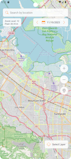
This application enables users to target precise geographical areas and to display maps showing crops characteristics, water and air quality, vegetation status and data for urban monitoring and planning, based on Earth Observation system (Copernicus Sentinel).
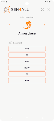
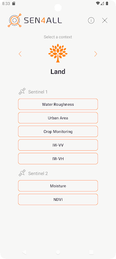
SEN4ALL relies on real-time data retrieved form Copernicus Sentinels 1, 2 and 5, including water surface roughness, urban area location and monitoring, crop monitoring, NDVI, soil moisture and concentration of multiple gases in the atmosphere.
To check if the device that you are using can support all the Copernicus services, the following traffic lights are giving a confirmation of your smartphone capabilities.
Gaming Features
Enjoy immersive gaming experience with various game modes.
Weather Features
Get accurate weather forecasts and real-time updates.
Smart Home
Control and monitor your home with smart features.
See the SEN4ALL in Action
Get the App Today
Available for Android 8.0 and above